Cedar Creek Greenway, Mt. Juliet: The 10-Foot-Wide Trail That Rewired How Locals Exercise
When Mt. Juliet built the Cedar Creek Greenway — a 10-foot-wide paved path that traces Cedar Creek through the heart of town — it quietly changed how thousands of residents exercise, commute, and spend weekend mornings. The greenway is one of Mt. Juliet's best (and most used) amenities, and it's the single most-referenced feature for anyone researching the active-lifestyle angle of Wilson County living.


When Mt. Juliet built the Cedar Creek Greenway — a 10-foot-wide paved path that traces Cedar Creek through the heart of town — it quietly changed how thousands of residents exercise, commute, and spend weekend mornings. The greenway is one of Mt. Juliet's best (and most used) amenities, and it's the single most-referenced feature for anyone researching the active-lifestyle angle of Wilson County living.
A practical way to think about it: the Cedar Creek Greenway is the closest thing Mt. Juliet has to a town-wide sidewalk. It connects subdivisions that were built a decade apart, runs past the city's most-used park, and shaves meaningful minutes off local walking and biking trips that would otherwise force a detour along busy arterial roads. On any given Saturday morning between 7 and 9, you'll see a rolling sample of the city's demographics — young parents pushing jogging strollers, retirees walking labradors, middle-school bike packs, and the occasional person in cycling kit mid-training loop.
Quick Facts
- Location: Mt. Juliet, TN — connects Charlie Daniels Park to Golden Bear Gateway and beyond
- Surface: Paved, 10 feet wide
- Cost: Free
- Dogs: Allowed on leash
- Strollers: Yes — flat, paved, family-friendly
- Bikes: Yes
- North Section length: ~2.2 miles out-and-back (32 ft elevation gain)
- South Section length: ~4 miles (98 ft elevation gain)
- Core segment: 1.1-mile paved trail from Charlie Daniels Park to Golden Bear Gateway
- Operated by: City of Mt. Juliet (Parks and Greenways)
- Trailhead parking: Free, on-site at Charlie Daniels Park
- Restrooms: Available at Charlie Daniels Park trailhead
- Typical hike-time (South Section): 1 to 1.5 hours at walking pace
What the Greenway Is
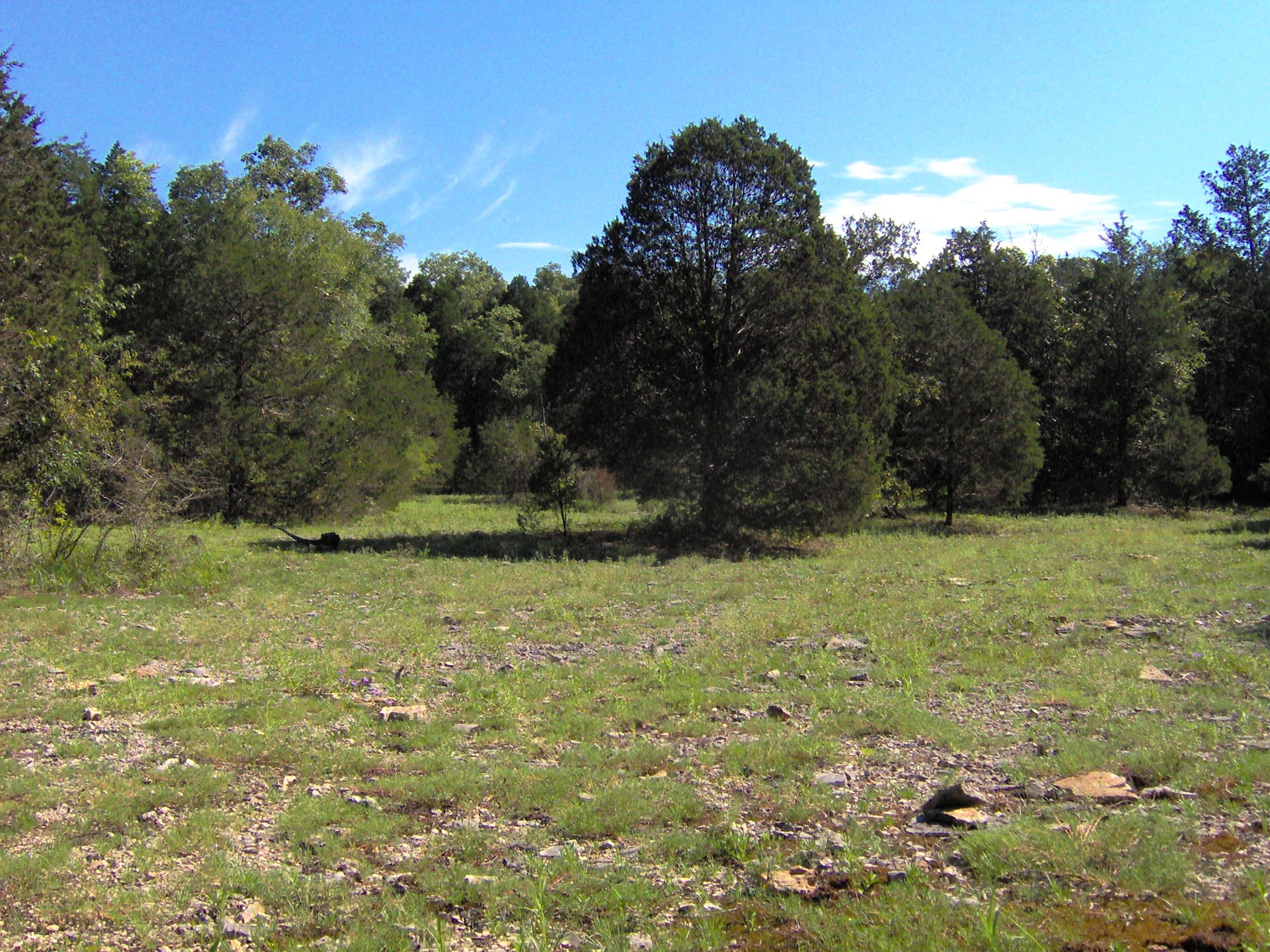
The Cedar Creek Greenway is a paved, multi-use trail that follows Cedar Creek through Mt. Juliet. It's designed for walking, running, dog walking, and cycling with low elevation change and consistent 10-foot width — enough for two-way traffic without anyone feeling crowded.
The trail's anchor is Charlie Daniels Park. From there, it extends along Cedar Creek to Golden Bear Gateway, connecting the Park Glen and Tuscan Gardens neighborhoods. Additional sections extend the greenway into two broader out-and-back loops, which trail apps label as "North" and "South" sections.
What makes the greenway distinctive is how integrated it is into actual Mt. Juliet residential life. Because it links subdivisions, it functions like a linear park — you can walk out your front door in the right part of Mt. Juliet and be on the greenway within a few minutes.
The Two Sections: North and South
North Section (~2.2 miles out-and-back). Shorter, flatter (32 ft total elevation gain). The easier of the two sections. Good for an early-morning jog, a stroller walk, or a casual bike ride. Popular with families with young kids.
South Section (~4 miles, moderate length). Longer (typically hiked 1 to 1.5 hours) with modest elevation changes (98 ft gain). Better for a real workout, a longer dog walk, or a slower bike ride with scenic breaks.
Both sections remain paved and 10 feet wide. Neither requires technical biking or hiking skill.
What It's Good For
Running. The consistent surface and low elevation make the greenway a reliable running route. Mt. Juliet's running community uses it heavily — if you're training for a 5K or 10K, this is the local default.
Cycling. Good for recreational and commuter cyclists. Width supports bike-plus-pedestrian traffic comfortably. Not a road-bike training surface — this is a rec trail, not a dedicated cycling facility — but for families, commuters, and casual riders, it's ideal.
Dog walking. Leash rules enforced. The shaded sections make it more comfortable than neighborhood sidewalks in summer.
Stroller-friendly family outings. Fully paved, mostly flat, with benches at intervals. Families with young kids use the greenway daily.
When to Go
Early morning (6–9 AM): peak regular-user traffic. Mt. Juliet's morning walkers are out. Busiest socially, not crowded enough to feel jammed.
Late morning / midday: thins out. Weekdays are nearly empty by 10 AM.
Afternoon: picks up again as school lets out and people head home. Summer afternoons can be hot on unshaded sections.
Evening (5:30–8 PM): peak social hours. Families, couples, post-work runners.
Season notes: the shaded sections make summer much more tolerable than a typical neighborhood sidewalk. Winter is underrated — the trail is clear year-round, and the cold keeps crowds down.
Getting There and Where to Park
The trail's most accessible anchor is Charlie Daniels Park in Mt. Juliet. Park there and you can access the Cedar Creek Greenway from the park's trailhead.
| From | Drive time to Charlie Daniels Park | Route |
|---|---|---|
| Central Mt. Juliet | 5–10 min | Local roads to Mt. Juliet Rd |
| Lebanon Public Square | ~25 min | I-40 West to Exit 226 |
| Watertown | ~35 min | US-70 West to Mt. Juliet |
| Old Hickory (Wilson side) | ~15 min | Local roads |
Best Times to Visit and Crowd Patterns
Weekday 6–8 AM: the serious runners, commuter cyclists, and dog walkers with 9-to-5 jobs. Moves fast, feels purposeful, rarely crowded enough to slow down.
Weekday 8–10 AM: stay-at-home parents, retirees, and walking groups. Slower pace, more conversation, more dogs.
Weekend 7–10 AM: the most-used hours of the week. Expect to see every demographic the trail serves.
The only time the greenway feels genuinely crowded is during a handful of city-organized events (5Ks, charity walks, Earth Day cleanups).
Nearby — What to Pair This With
- Charlie Daniels Park, Mt. Juliet — the greenway's main anchor and the easiest place to park.
- Living in Mt. Juliet, Tennessee — the full neighborhood guide if Mt. Juliet is on a relocation shortlist.
- Providence Marketplace: Shopping & Dining in Mt. Juliet — 5 minutes away for a post-walk coffee or meal.
- Long Hunter State Park — for a weekend when you want something bigger than the greenway.
Frequently Asked Questions
How long is the Cedar Creek Greenway in Mt. Juliet? There are two main sections. The North Section is roughly 2.2 miles out-and-back. The South Section is roughly 4 miles. The core paved segment from Charlie Daniels Park to Golden Bear Gateway is 1.1 miles.
Is the Cedar Creek Greenway paved? Yes. The trail is paved and 10 feet wide throughout.
Is the greenway stroller-friendly? Yes. The paved surface, low elevation change, and consistent width make it fully stroller-accessible.
Are dogs allowed on the Cedar Creek Greenway? Yes, on leash. The trail is one of the most popular dog-walking routes in Mt. Juliet.
Is the greenway free to use? Yes. No admission, no permit, no parking fee.
Can you bike on the Cedar Creek Greenway? Yes. The trail is designed for walking, running, and cycling — it's a multi-use greenway.
Is the Cedar Creek Greenway lit at night? Lighting varies by section. Most rural and wooded portions are unlit — plan to use the greenway in daylight hours unless you know a specific lit section well.
A Local's Take
For buyers moving to Mt. Juliet, the Cedar Creek Greenway does more for the "active lifestyle" pitch than any builder amenity could. It's free, it's maintained, it connects neighborhoods to each other in ways that subdivisions rarely do, and it's in regular use by the people already here.
A useful way to test whether a Mt. Juliet home is going to work long-term: walk over to the nearest greenway access point from the listing, go a quarter mile, and think through where you'd realistically go on a Saturday morning. If that scenario clicks, the rest of the buying decision usually clicks with it.
Want more Wilson County guides like this? Sign up for the twice-monthly newsletter — local guides, neighborhood updates, and the occasional market note.
Written by Jacob Armbrester, Real Estate Broker with Compass. Published 2026-04-18. Last updated 2026-04-18.


Jacob Armbrester
A Nashville native, licensed real estate broker, and your go-to guide for all things Middle Tennessee. I’m here to help you uncover the perfect neighborhood, understand the market, and move confidently. From relocation tips to hidden local gems, I’ve got your back.

Jacob Armbrester is a real estate agent affiliated with compass, a licensed real estate broker and abides by equal housing opportunity laws. all material presented herein is intended for informational purposes only...
Contact Us
Jacob Armbrester is a real estate agent affiliated with compass, a licensed real estate broker and abides by equal housing opportunity laws. all material presented herein is intended for informational purposes only. information is compiled from sources deemed reliable but is subject to errors, omissions, changes in price, condition, sale, or withdrawal without notice. no statement is made as to accuracy of any description. all measurements and square footages are approximate. this is not intended to solicit property already listed. nothing herein shall be construed as legal, accounting or other professional advice outside the realm of real estate brokerage.